Manhole Inspections
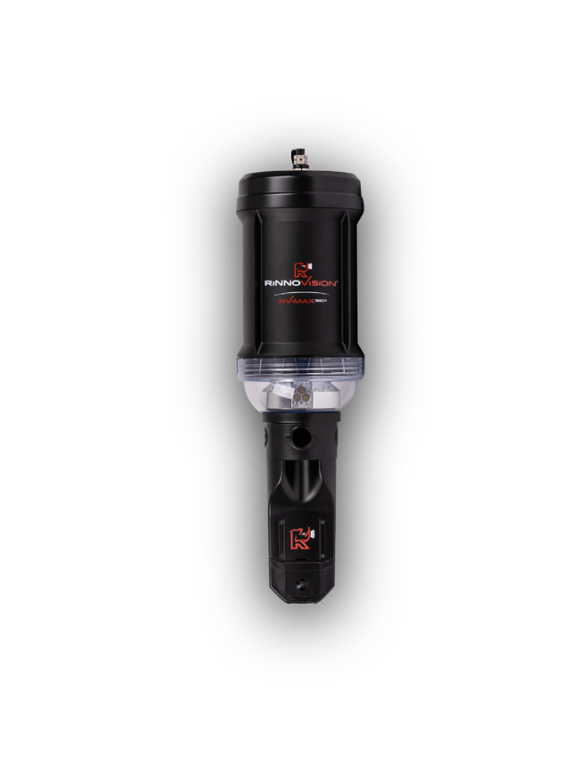
RinnoVision RV-MAX 360 Manhole Inspections
Johnson Jet-Line inspects manholes with the RinnoVision RV-MAX 360 and 360S: 4K, 360-degree cameras lowered from the surface by one operator. No one enters a confined space, and a full inspection takes one to three minutes per structure.
A manhole inspection documents the frame and cover, chimney, cone, walls, bench and channel, and the pipe connections. Cracks, infiltration, root intrusion and failing joints show up long before they cause a backup, and the footage supports maintenance planning and NASSCO MACP-based reporting.
Request a QuoteWant to buy one? Jet Line Sales & Service
What You Get From Every Inspection
4K 360° Video
Full spherical coverage of the structure
- Sharper, lower-distortion picture of walls, cone and bench
- 6,600 lumen LED lighting, six modes and a side spotlight
- Live view while recording
3D Point Cloud Models
Measurements, not just pictures
- 3D models for side-pipe and mainline measurements
- RV-MAX 360S: sub-quarter-inch point clouds for Level 2 MACP
- Open .PLY export for mapping and rehab planning
Safe, Fast, Documented
One operator, topside
- No confined-space entry
- Footage uploads automatically for review and sharing
- AI defect coding and Level 2 MACP reports through Pallon
RV-MAX 360 vs. RV-MAX 360S
| RV-MAX 360 | RV-MAX 360S | |
|---|---|---|
| Video | 360° 4K MP4 | 360° 4K (8.1 MP) MP4, 5 to 30 fps |
| Lighting | 6,600 lm, 6 modes, side spotlight | 6,600 lm, 6 modes plus side spotlight |
| 3D models | 96-98% precision, PLY export | Sub-quarter-inch point clouds, PLY export |
| Depth readings | Not live | Live and offline |
| Durability | IP68, drop-tested | IP68, 6 ft underwater for 1 hr |
| Pole reach | Up to 29.5 ft fiberglass | 6 to 29.5 ft fiberglass |
| Software | RinnoView, RinnoCloud, Pallon AI | RinnoView, RinnoCloud, Pallon AI |
How It Works
- Capture: one operator records a full 360° inspection from the surface in one to three minutes.
- Convert: RinnoView turns footage into digital inspection files that are easy to review and share.
- Code: Pallon AI detects, classifies and measures defects, and produces Level 2 MACP reports with a condition rating.
- Act: use solid data for maintenance planning, budgeting and risk decisions.
Who Uses Manhole Inspections
Municipalities inspect more manholes faster and remove the risk of confined-space entry. Engineering firms get measurable 3D data for mapping and rehabilitation planning. Contractors and utilities get documented condition records before and after repairs. Pair inspections with our scheduled maintenance programs and Diamond Maps sewer mapping.
Frequently Asked Questions
How long does a manhole inspection take?
One to three minutes per manhole with one operator and no confined-space entry.
Does it work with NASSCO MACP?
Yes. The 360S captures measurement-ready 3D data for Level 2 MACP, and Pallon AI can produce MACP coded reports.
How deep can the camera reach?
The fiberglass pole reaches up to 29.5 feet.
Is it waterproof?
Both models are IP68 rated and drop-tested; the 360S is rated for 6 feet underwater for one hour.
Can I buy a RinnoVision camera?
Yes. Jet Line Sales & Service, our sister company, sells and supports RinnoVision manhole cameras. See the RinnoVision page.
Maintenance Programs & Sewer Mapping
Maintenance Programs
At JJL, we offer our customers scheduled maintenance programs, on your choice of terms, making sure that your sewer system stays in compliance with your insurance company. This is designed to stay on top of your potential maintenance issues. Along with our services, we provide you typed cleaning logs and state-of-the-art inspection reports so you know where your potential bad lines are located. Contact us to set up a free consultation.
Sewer Mapping
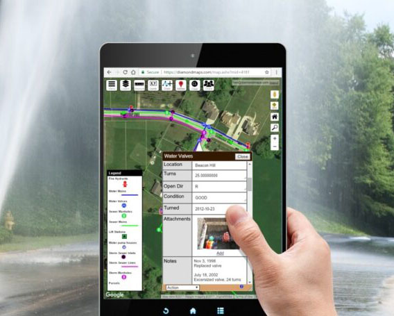
You can depend on JJL for digital mapping using the Diamond Maps Program. Diamond Maps is a simple cloud-based GIS/Mapping application designed to help municipalities and rural utilities map their sewer and water infrastructure and track maintenance. We locate and map underground utilities including manholes, catch basins, sewer laterals, agricultural tile lines, and inlets/outlets for businesses and municipalities. All of these points are collected in survey grade which gives our customers the most accurate data and maps.
How can we help?
Find out more about what Johnson Jet-Line, Inc can do for you and your projects and request a quote.
Interested in owning a RinnoVision RV-MAX 360 manhole camera?
We run this equipment every day. Our sister company, Jet Line Sales & Service, sells it.
See RinnoVision at Jet Line Sales →